Klarety for Research
Satellite-scale evidence for your next paper, in minutes.
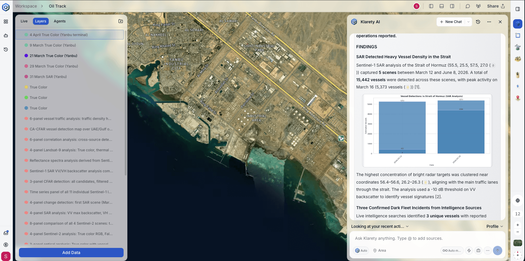
Ask a research question in plain English. Klarety's AI agent pulls real satellite and geospatial data, runs the analysis, and returns findings with every number traced back to its source, ready for a methods section.
01 / The problem
Remote sensing data is public. Using it rigorously is not easy.
Sentinel, Landsat, and MODIS archives are free and public. Turning them into a defensible result still takes a GIS specialist, weeks of preprocessing, and code your committee has to trust.
The data is not the bottleneck
Public archives cover the whole planet. Processing them correctly is what takes time.
Rigor cannot be shortcut
A result without a traceable source or method does not survive peer review.
One researcher, many roles
Data engineer, GIS analyst, and statistician, often all one person, on a deadline.
02 / Methodology and citations
Every number, traced back to its source.
Klarety's agent is built to cite, not assert. If a claim cannot be traced to a source, it does not get written into the result.
Cited by default
Every figure carries a source: a scene ID, a dataset, or a calculation, not a bare number.
The code is not hidden
The analysis that produced a result is visible while it runs. Nothing is a black box.
Documented methodology
Each analysis ships with a methodology record, the kind a methods section already expects.
Example, from a real analysis
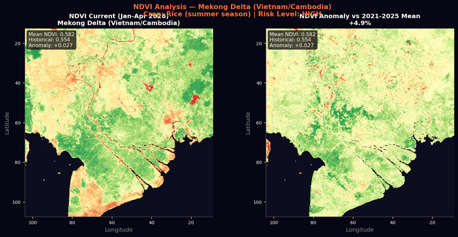
“Mean NDVI across the study area increased to 0.582 (+4.9% vs. the 2021–2025 seasonal mean of 0.554), consistent with early-season canopy recovery.”
Source: Sentinel-2 L2A, NDVI composite, Jan–Apr 2026
03 / Data sources
Built on the archives your field already trusts.
Klarety draws on the same public satellite and geospatial archives already cited in peer-reviewed research, unified into one place you can query directly.
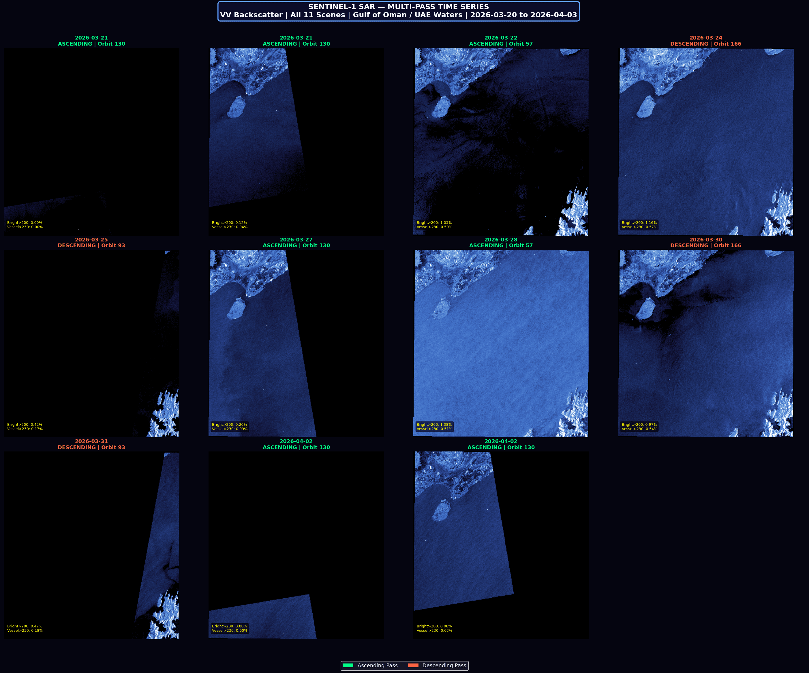
- Sentinel-1 (SAR)
- All-weather, day-and-night radar imaging
- Sentinel-2
- Optical, multispectral, 10m resolution
- Landsat 8/9
- Multidecadal optical archive
- MODIS
- Daily global coverage
- NAIP
- High-resolution US aerial imagery, 2003 to present
- Copernicus DEM
- Global elevation model
- NASA EMIT
- Hyperspectral imaging
- ICESat-2 and SWOT
- Elevation and surface water altimetry
06 / Compute
Serious compute, without a lab budget.
Large raster jobs and heavier models run on powerful, on-demand GPUs through our partner Lightning AI. You never manage a cluster or wait on a shared department server. Lightning AI.
07 / Data handling
Your research data, kept private and yours.
Unpublished results and sensitive study areas deserve real protection. Your data is never shared, and it is always yours to export.
Private LLM
Available for institutions, so your data never reaches a third party.
Encrypted everywhere
Your data is encrypted at rest and in transit.
Always yours
Export your data anytime, in open formats, no lock-in.
Frequently Asked Questions
Everything you need to know about Klarety AI and custom geospatial pipelines.
Get started
Bring your research question. See the evidence.
Tell us what you are studying. We will show you Klarety running a real analysis on it.